
CORCOVADO NATIONAL PARK
General Trip Information - Sirena - La Leona - Los Patos&San Pedrillo - Tourist Facilities - Map
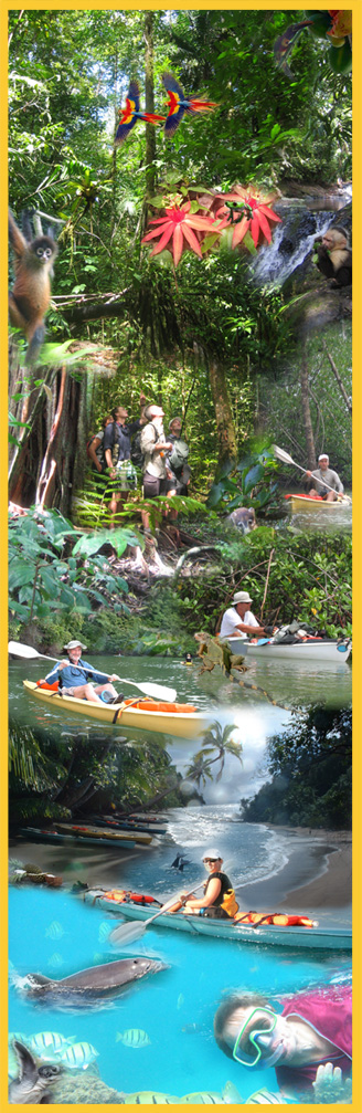
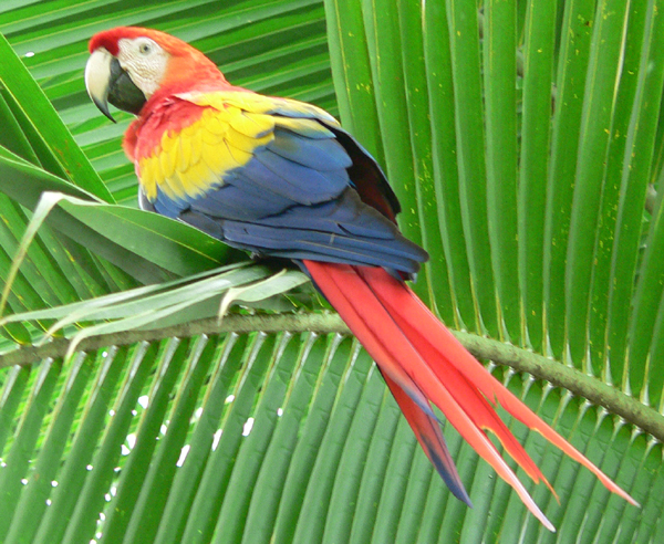
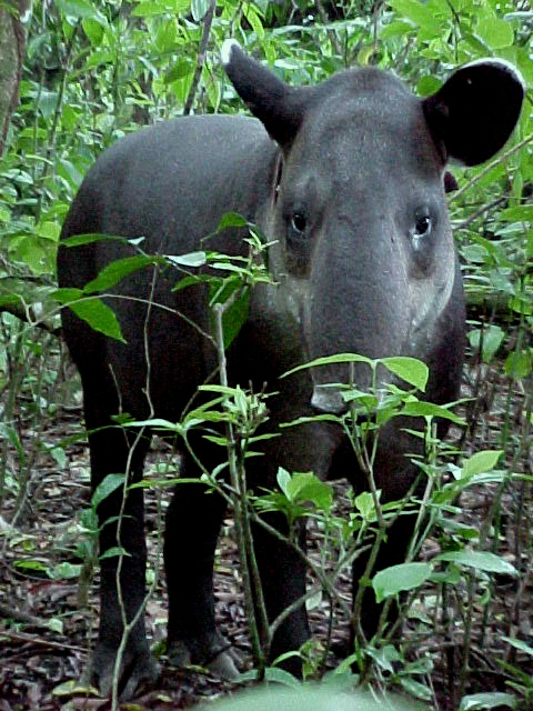
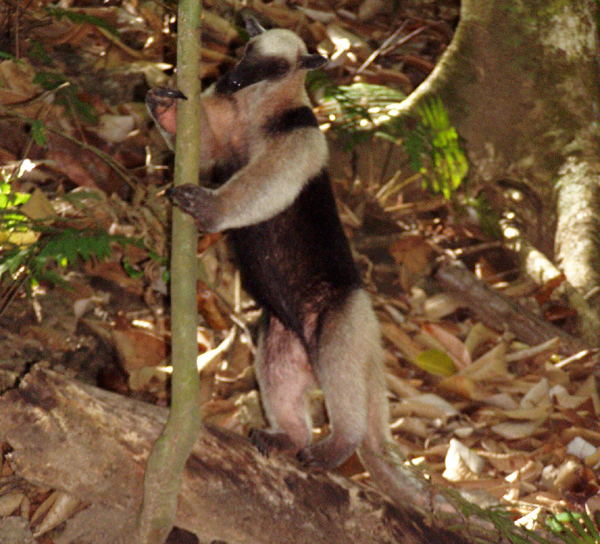
Location: South Western sector of the Osa Peninsula, Puntarenas Province, South Pacific region of Costa Rica. Legal aspects: Creation: Decree No. 53 57 A, October 24, 1.975, Addendum: Decree No. 11148 A, February 5, 1.980, Ratification: Law No. 6794, August 25, 1982. Surface Area: 41, 788 hectares Maximum Altitude: 782 meters above sea level Climate: Hot, rainy and very humid. Weather: Dry season, mid-December to mid-April, with sporadic rain showers. Rainy Season: mid-April to mid-December Precipitation: 5.000 - 5.500 mm per year in mountainous zones. 2.500 - 3.500 mm per year on the coast. Access: Corcovado is located 368 km from San Jose, following the Pan American Highway south, taking the detour toward Puerto Jimenez at the community of Chacarita. It is also possible to enter by boat from Sierpe, located 15 km from Palmar de Osa. There is an airstrip in Sirena Ranger station, small aircrafts flue in, there is an aero taxi located in Puerto Jimenez and several in San Jose. The park is located in the pacific coast, in the Península de Osa, in the province of Puntarenas. It was establish by means of Executive Decree No. 5357-A, October 24, 1975. It has an area of 54. 538 hectares in the land part and 2.400 in the sea part. Corcovado is located in the life zone that correspond to the very humid Tropical forest in the south pacific of Costa Rica and you can be sure that no other wild area in the country protects plants and animal as this park. This wild area is considered an excellent life laboratory, in which you can study the structure and function of the tropical ecosystems and the relationship between them. The very humid forests of Corcovado, are some of the last places that still maintain the ecosystem of the very humid tropical forests in the American pacific, with precipitation over 5.000mm annual. This park helps the investigation and scientific studies and allows the environment education. There are like 500 species of trees in the whole park, which is equivalent to the fourth part of all the tree species in Costa Rica. The tropical rain forests protected in the area, no only constitute the best ecosystem in the pacific, but the last of them in Central America. The flora of the park is constituted in the most by the very humid tropical forest with the following habitats: The mountain forest, the cloudy forest, the prairie forest, the swamp forest, the "Yolillal", the herbaceous swamp, the mangle, the sheer flora and the coast flora. The park protects several endangered species like cats, big reptiles, species of birds of restricted distribution. We know the existence of 104 mammal species, 367 birds, 117 amphibian and reptiles and 40 species of fresh water fish. In the wild life we can be notice the danta, the jaguar, the puma, the white face monkey, squirrel, congos, and others. This park is one of the most important conservation areas for the protection of lizards and crocodiles. The park entrance implies the use of the ranger station facilities, which were not built for tourist activity, but for a natural and rustic experience is perfect. There is no permanent electricity and there are no telephones. The only means of communication is a government radio system. It is not possible to buy anything throughout the circuit. You must bring all necessary items upon entering the park. Note: The trails in Corcovado are not totally signed, so is highly recommended to go with a local guide who knows the area and wuold help to avoid accidents. Meal schedule: Breakfast 6:30am to 7:00am Lunch 11:30am to 12:00pm Dinner 6:30pm to 7:00pm There is potable water available in each station. Basic items to bring on your trip: 1.Flashlight 2.Personal hygiene things ( soap, towel, toothbrush and toothpaste, etc.) 3.Sheets, if you are using the accommodations. 4. Tent, if you are camping. Tent rental is not available in the park. 5. Repellent, against "mosquitos" and sun protection. |
;)
;)
;)
This is a priority station for scientific investigation in tropical ecology, therefore the tourists have to adapt to any restrictions that may occur. Also the Park has restriction accord the quantity of visitants per day, that's why you have to reserve at less two weeks before your trip, reservation can´t be made until a month before the due date. Remember thtat the priority of the park
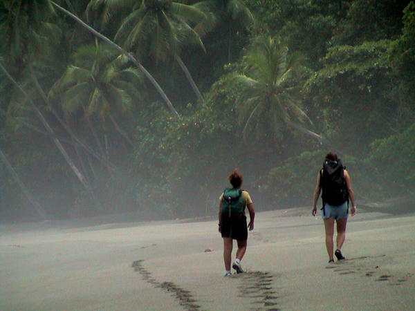
is the protection and reserch. From Los Patos to La Sirena it's a 20km hike. The first 5km until you get to the river Cedral have some ups and downs, the last 15km are flat. You will cross 3 rivers: Cedral, Sirena y Pavo. In the rainy season you must consult regarding the river crossings. These trails are heavily walked by visitors. Specialy in this trail is very important to go with a person who already knows the area. Access walking from La Leona: It's a 16km hike from La Leona to Sirena along the beach. This trail has two important points where you will have to consider the high tides. First, is a rocky zone before an island called La Chancha, 1Okm from Sirena. The second one is Salsipuedes, 6km from Sirena. Also note that Rio Claro needs to be crossed at low tide, 1.5km from Sirena. It is highly recommended to get information from a local guide. Access walking from San Pedrillo: It's a 22km hike along the beach. You will cross 3 rivers; the important ones are Rio Llorona and Rio Sirena. You will need tide information from the rangers. The walk along the beach will expose you to direct sun for several hours. Also, it's difficult to walk on the sand during high tide. There is no fresh water for the last 18km. You have to bring enough for all the trip. Access by ocean: It's possible to enter Sirena by ocean, although it requires renting a small boat. Access by air: Sirena has a small air
strip designed for small aircrafts which can be booked in Puerto
Jimenez ( 14 minute flight ) or from San Jose ( 1 hour) Services offered: • Meals • Trails., there are 8 trails; Guanacaste (1350m.), Espaveles (1580m.), Rio Pavo (650m.), Ollas (3600m.), Corcovado (2550m.), Rio Claro (3750m.), Naranjos (1 180m.) y Sirena (700m.) • Camping zone; there is a covered wooden platform for the rainy season, and another area in the open air • Shared showers and bathrooms and an area to wash clothing • Accommodations: all rooms have bunk beds. Each visitor has the right to a bed and will be expected to share the room with other visitors. • Electricity, this area is run by solar panels, which means electricity usage is restricted, please ask rangers regarding |
;)
;)
;)
LA LEONA RANGER STATION
Access from Puerto Jimenez: Two hours by a taxi to Carate, which is 3.5 km from La Leona. The walk from Carate will take 45 minutes. Every day, there is a collective taxi that leaves Puerto Jimenez at 6:00am/1:00pm and returns from Carate at 8:30 am/4:00pm. Services Offered: • Trails: this area has two trails, the first (780m.) that goes along a steep slope and the second (2000m.), which is flat and parallels with the coast. This last trail reaches the river mouth at Rio Madrigal. • Camping • Shared showers and bathrooms • Electricity comes from a
diesel based generator, therefore electricity usage is limited. Los Patos and San Pedrillo.
Tourist Facilities Near Corcovado.
If you think about Los Patos, in the east of Corcovado, the station offers only camping area, however La Danta Lodge is located near the station entrance, offers lodging, meals and also experienced guides who can accompany you in the mountain.. To leave Los Patos you should travel 12kms. from La Plama, this journey can be made hiking, in tractor or horse, in dry season it is possible to arrive until the entrance of Cerro de Oro Ecolodge in a 4WD vehicule.
Recommendations
|
| CORCOVADO MAPS | CLICK ON MAP TO ENLARGE |
;) |
;) |
Fuente:© SINAC, San José, Costa Rica
Tours - Adventure Packages - Hotels - Photo Gallery - Maps -
How to Get here - Trasportation - Other Destinations
Aventuras Tropicales Golfo Dulce, Puerto Jimenez, Peninsula de Osa, Costa Rica
mail us at: info@aventurastropicales.com
Copyright © www.aventurastropicales.com
![]()